Image

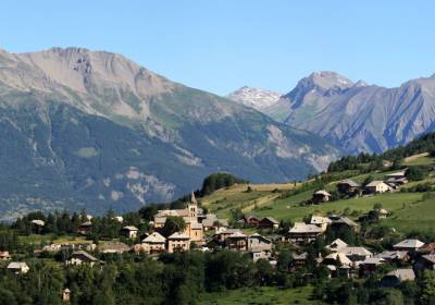
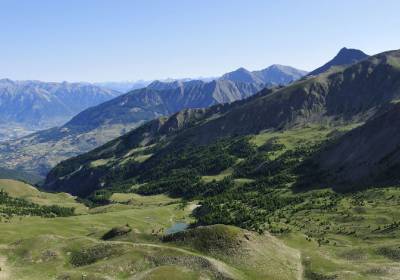
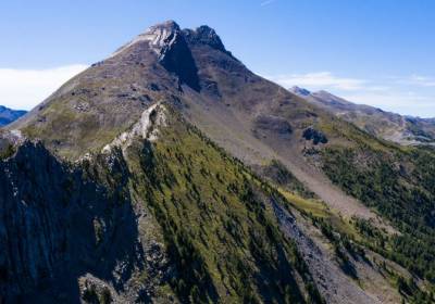
Hiking in Les Orres means 160 km of trails for all levels, 16 signposted itineraries, and a positive vertical drop from 15 to 1000 m.
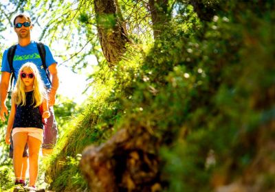
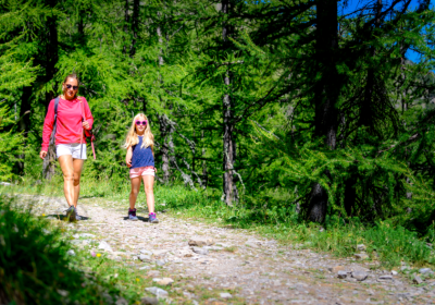
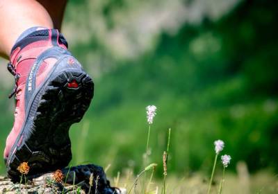
Enjoy the fresh air, breathtaking scenery, naps in the grass, picnics in the meadows or by the side of a stream. Whether you're a sports enthusiast with a penchant for steep trails or a lover of contemplative walks, choose your itinerary, put on your mountain boots, stroll along the paths and take a deep breath of fresh air!
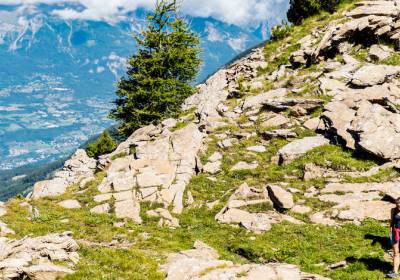
The Pic Vert, Prélongis and Pousterle lifts give you access to the upper ski area with the pedestrian pass.
From spring to autumn, trails are accessible depending on snow conditions.
With the PASSP'ORRES MULTI-ACTIVITIES PASS, enjoy unlimited access to the pedestrian chairlifts and the Préclaux carpet all summer long.
Easy walks of between 1h and 1h30 to get some fresh air and enjoy the shade of the larch trees(La Voie des sages, La bergerie Gautier and its picnic area), discover the rural heritage of Les Orres(Le circuit du seigneur and Lou Pastre-Petite boucle) and even take in the view from the Belvedere via the Pousterle chairlift.

An easy out-and-back hike through the larch forests of Les Orres. A great spot for a picnic awaits at the destination!
Thematic course (1h).
This easy trail is punctuated with instructions from our predecessors, whose sayings go hand in hand with mountain life.
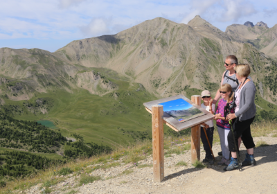
Head off to Belvédère and its viewpoint indicator to marvel at the exceptional panorama with views of the Aupillon and Écrins massifs.
Accessible for 4 x 4 pushchairs...

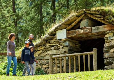
From the Pra Païsset parking lot, head for the Gautier hut (fully restored), and its picnic area in the mountain pastures.
Thematic course. 2 levels: 4/5 hrs (16km) or 1:30 (5.5km).
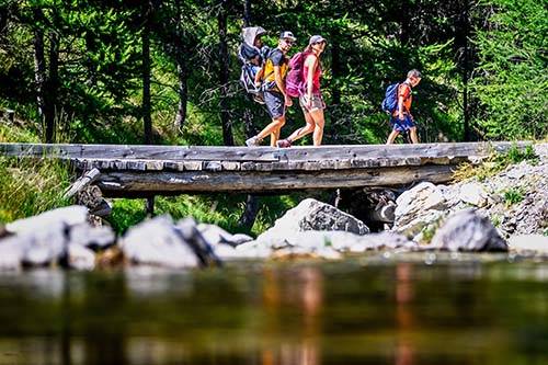
Do you hike from time to time, are the kids used to walking, or do you just want to get away from it all and enjoy the mountains of the Hautes-Alpes without coming home with painful aches and pains? These half-day outings, lasting between 2h and 3h30, are just what you need!
For a refreshing stroll, head for the emblematic Lac de Sainte-Marguerite, near the Sources de Jérusalem, or explore the aptly named Au frais des mélèzes. The Balcon des vallons offers breathtaking views, and nature and heritage lovers will be delighted by the Circuit de l'Adret or the Sentier Lou pastre - Grande boucle.
Follow our Orrian shepherd "Lou Pastre" to discover, throughout the hike, how the inhabitants have used the elements to best adapt to the harsh mountain climate. A...

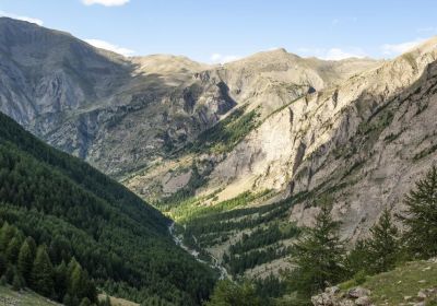
A hike in the heart of a wild and unspoiled landscape, surrounded by snow-capped peaks until early summer. This place is renowned for its abundant wildlife, including marmots...

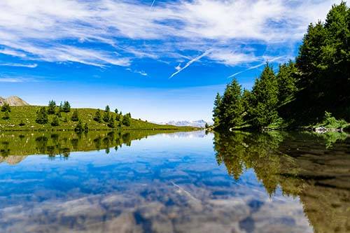
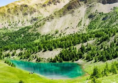
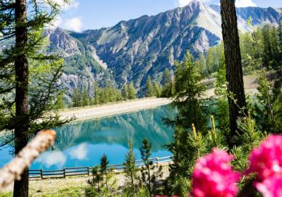
The must-do hike in Les Orres! Lake Sainte Marguerite is an ideal spot for a cool picnic. In the heart of beautiful alpine pastures still grazed by cows, you can hear and see...
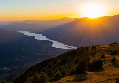
A hike with a very beautiful viewpoint and a 360° panorama over the valleys of Les Orres, La Durance, and Crévoux, as well as a diverse flora. Le Méale peaks at 2426m
La randonnée incontournable des Orres ! Départ depuis le sommet du télésiège Pousterle, en passant par le Belvédère (n°4). Balade longue et aérienne.
Un havre de paix au...

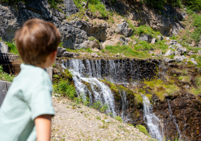
Follow the water’s path and explore the beautiful larch forests of Les Orres, with stunning views over the valley below.

A round trip in the shade of the forest. Beware of the trail with the same name, as its route is different.

All along this trail, which is suitable for family groups of walkers, you can enjoy panoramic views over the Grand Vallon and Les Orres.
This is a long downhill hike in the shade which winds through the larch forest, past the Grand-Clos and its water reservoir which turns into a mirror lake.
3hrs30
The springs of Jerusalem are an easy hike to do with the family, to cool off in the middle of summer.
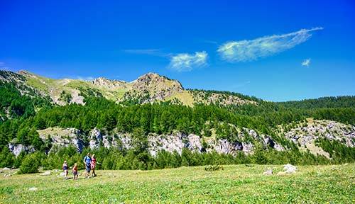
It's getting serious! Longer distances, steeper ascents and descents: while still accessible, these trails are suitable for regular hikers or those who are already a bit sporty. Magnificent panoramas await you on arrival.
To enjoy these breathtaking views, take the sentier des cairns, the Col de Terre Rouge (caution, this area is closed at the beginning of July to protect the fragile Tétras Lyre), the Méale from the Chef-lieu des Orres, the Col de l'Âne or the Aérien. The sporty side will give your legs a real thrill, and you won't want to miss the famous Lac de Sainte-Marguerite hike.
Magnificent panoramas await you on this technical hike! You have three options depending on your fitness level: reach the Col de Girabeau (2500m), continue to Petit Parpaillon...

A vertiginous hike along the ridge line before plunging into the forest.
From Sainte-Marguerite Lake, there is a challenging climb up to the Pass with views over the Haute-Provence Alp
Very difficult.(about 1:00 hr to go).

Follow the Petit Vallon stream upstream to the Petit Vallon hut, then continue to its source. From there, take a steeper and more challenging trail. This final section requires...
This crossing overlooks Serre-Ponçon, Les Ecrins and the Terres Rouges from Pic Vert’s summit.
Very difficult.(about 1:30 hrs to go).
1 hour30: Average difficulty. Departure from the top of Pousterle chairlift
Path running alongside the Pousterle ski slope.
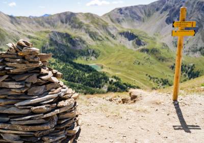
Follow the cairns, beacons for hikers, to the viewpoint indicator and its 360° view.
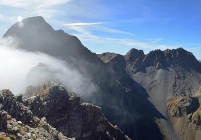
High points and aerial trails are the main themes of these hikes, which are reserved for seasoned walkers with mountain feet.
These beautiful day outings will take you up to the Pic du Boussolenc (2282 m) and the summit of the Aupillon (2926 m).

Panoramic views and a challenging hike to one of the iconic peaks of Les Orres. This route is reserved for experienced hikers who are not afraid of heights.
It is...

An unforgettable hike for those who are not afraid of heights and heights.

Starting from the lake (remember to add the time, distance, and elevation gain to the lake), hike through a beautiful valley to reach a panoramic view at Col de l’Âne, Côte...

Starting from Lake Sainte-Marguerite (remember to add the time, distance, and elevation gain to the lake), follow the ridges of Les Orres to the summit of Aupillon, where you...

Take pleasure in walking in nature with snowshoes.
Soft and magical sensations, full of surprise and discovery.

Escape into nature with Sarah on a snowshoe outing. Walking in the great outdoors provides a moment to relax, breathe in harmony with your steps, and awaken your senses....

Discover professionals and outdoor sports enthusiasts to accompany you in hiking, via ferrata, climbing, canyoning, high mountain activities, tree climbing, paragliding, and...

A selection of 17 hikes of all levels, accessible without chairlifts, to take with you.
Departing from Le Chef-lieu, Les Ribes, Les Orres 1650 and 1800, these itineraries range from easy family outings to medium, difficult and very difficult hikes: explore the trails of Le Méale, Le Petit Vallon, Le Col des Orres, La Cabane du Nain Rouge and many other places to discover!
On sale at the Tourist Office
Price: €12
Prefer to hike from the chairlifts?

The mountain is grazed all summer long. When approaching a herd, pause, do not run. Don't pet or threaten the animals. Keep your dog on a leash.

Many of us enjoy the pure mountain air and the flora and fauna. To keep our landscapes as beautiful and protected as possible, let's follow a few simple, common-sense rules to preserve what surrounds us: