Image


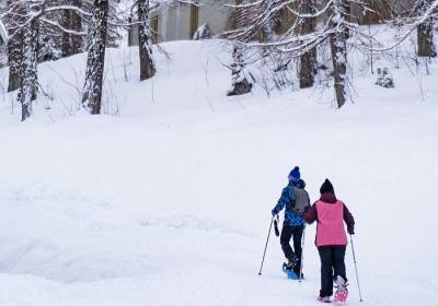
Take to the snow-covered trails at Les Orres resort or the Chef-lieu, and discover the mountain landscape at your own pace. Itineraries follow ancient Orrian canals or meander under larch trees to viewpoints or old huts. A peaceful immersion in nature.
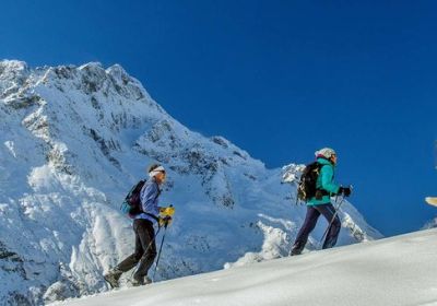
If you prefer guided walks, our mountain guides offer a variety of outings for all levels.


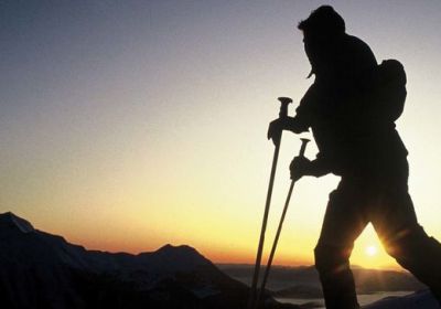
The mountains are an ever-changing environment that demands constant care and attention. If you're looking for a safe outing, but also want to discover secret trails or try out practices that promote your well-being, call on mountain professionals! These trained, certified and experienced guides will guide you through the forests and ridges of Les Orres.

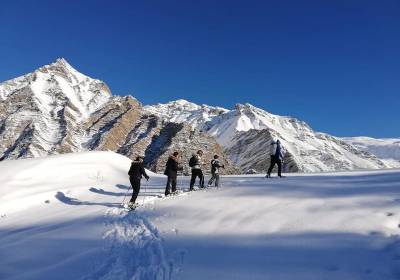
Supervised by mountain professionals, our ski instructors will introduce you to the joys of snowshoeing. From beginners to athletes, including children, come and explore all...
An unforgettable evening under the stars:
A snowshoe hike followed by a descent on a Snake Gliss (sledge train) for 4 km. An amazing evening adventure!
Let’s enjoy a friendly, fun activity in the snow with traditional or ultra-light snowshoes! Hikes leaving from Les Orres 1650 m and/or on the crests using the chairlifts.
Discover the mountains on snowshoes with Julien, a state-certified mountain guide: stunning landscapes within your reach, safely explored from Les Orres. Enjoy beautiful hikes...
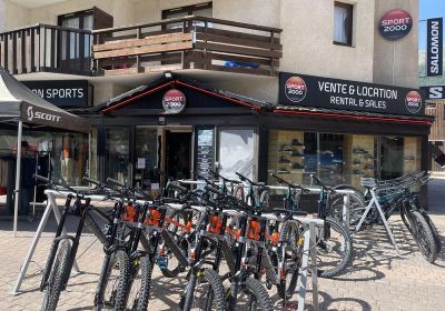
Sale of clothing and accessories. Hire of ski, surfing and snowscoot equipment, etc. Free ski storage

RENTAL:
► Adult, junior, child, free-ride, DH, Enduro mountain bikes (Commencal, Scott)
► Electric mountain bikes
► Via ferrata equipment, baby carrier......

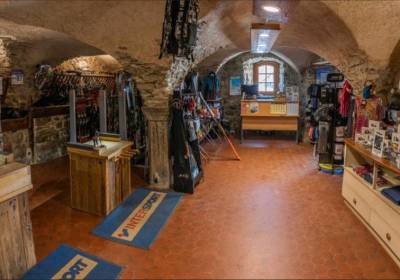
Our store is located in the heart of Les Orres 1800 resort. We offer sales of equipment, clothing, accessories, as well as winter and summer equipment rentals: sleds, skis,...
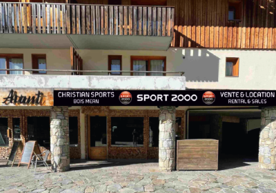
Welcome to our Sport 2000 Christian Sports shop in Les Orres, right at the foot of the slopes: Winter and summer alike, sale and hire of ski, snowboard, snowshoe, mountain bike...

Equipment hire - sale
Accessories / Workshop / Ski storage
Snowscoot hire

Sale of clothing and accessories. Hire of ski, surfing and snowscoot equipment, etc.
Free ski storage (see terms and conditions in store).


Sale of clothing and accessories. Hire of ski, surfing and snowscoot equipment, etc.
Free ski storage (see terms and conditions in store). Latest generation repair...
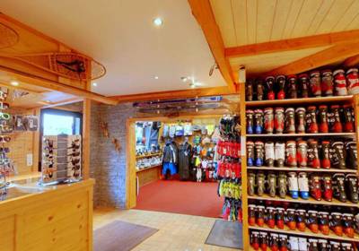
Equipment hire - sale
Clothing, Accessories, Workshop, Snowscoot hire
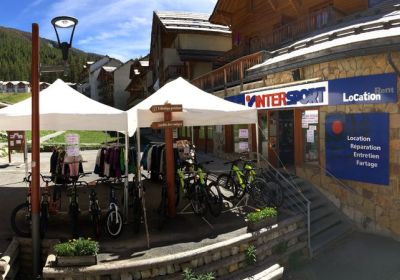
Vincent and his team welcome you to your Intersport store in Les Orres 1800.
Top-quality equipment and professional advice so that you can make the most of the slopes....

In winter, at the foot of the slopes, sale of ski and snowboard equipment, accessories, clothing, as well as rental of skis, snowboards, snowshoes, and sleds... In summer, sale...

Our aim, the best quality/price ratio! With over 30 years’ experience in the hire of ski equipment, our team is delighted to provide you with the necessary expert advice to...
First of all, you need to download an application on your device that can read this format.
For Android: numerous applications are available on Google Play. Among these, we've selected Geo Tracker for its free, easy-to-use, French-language interface, or the GPX viewer app. There's also Ign Rando, the IGN app, Iphigénie, Visorando... Give them a try!
For iOS (iPhone, iPad): several apps are available on the App Store: Ign Rando, Visorando, Alltrails Rando, Iphigénie...
Les Orres Tourist Office offers you the opportunity to download files in "GPX" format (available on each itinerary). These files contain geographical data which form a route.
Download the .gpx file to your cell phone or GPS. The file is then saved to your device's storage space.
OPEN .GPX TRAIL
Open your app and import the .GPX file saved in your device. Your smartphone will display your position in relation to the trail on a map, allowing you to follow your progress step by step.
Enjoy the ride!
Il vous faut :
Vous pouvez les louer auprès des magasins et prestataires de sport de la station.
Non, il y a des sentiers balisés, spécialement prévus pour les balades en raquette. Vous n’êtes pas autorisé à vous aventurer sur les pistes de ski, pour la sécurité de tous.
C’est possible, mais seulement si vous connaissez bien la montagne, les conditions et les itinéraires. Sinon, il est préférable de rester sur le sentiers balisés ou de faire appel à un accompagnateur en montagne.
Non, les itinéraires partent directement du Chef-Lieu des Orres, des Orres 1550, 1650 ou 1800.
