Image


The resort features four marked trails: Le chemin du garde, La Mazelière, Le Méale and L'Aupillon, all specially designed by and for mountain hiking enthusiasts. The trails, listed in increasing order of difficulty (from novice to expert) are ideal for exploring Les Orres and the surrounding peaks.
Excursions, exploring local trails, set off from the Tourist Office every Monday at 6pm.

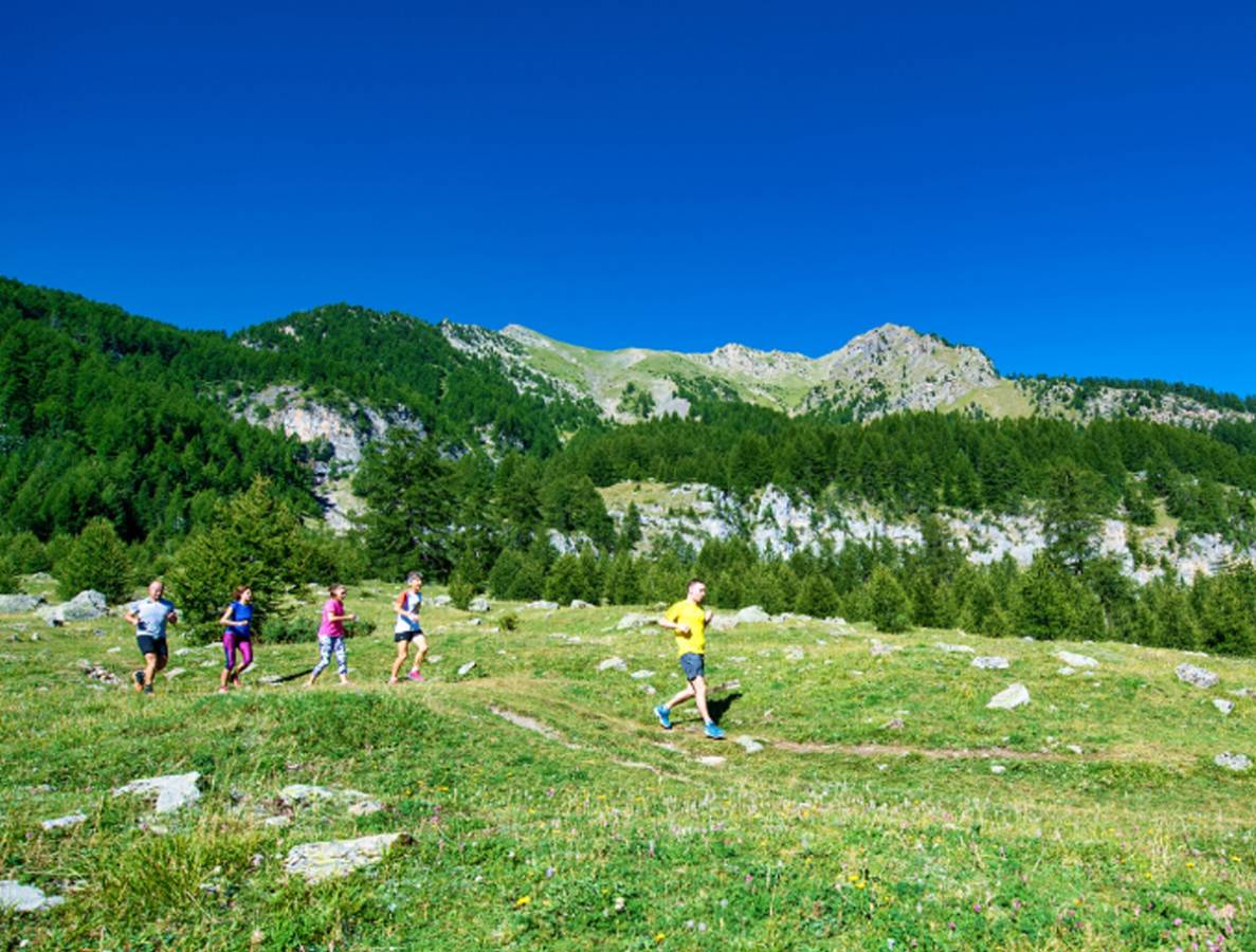
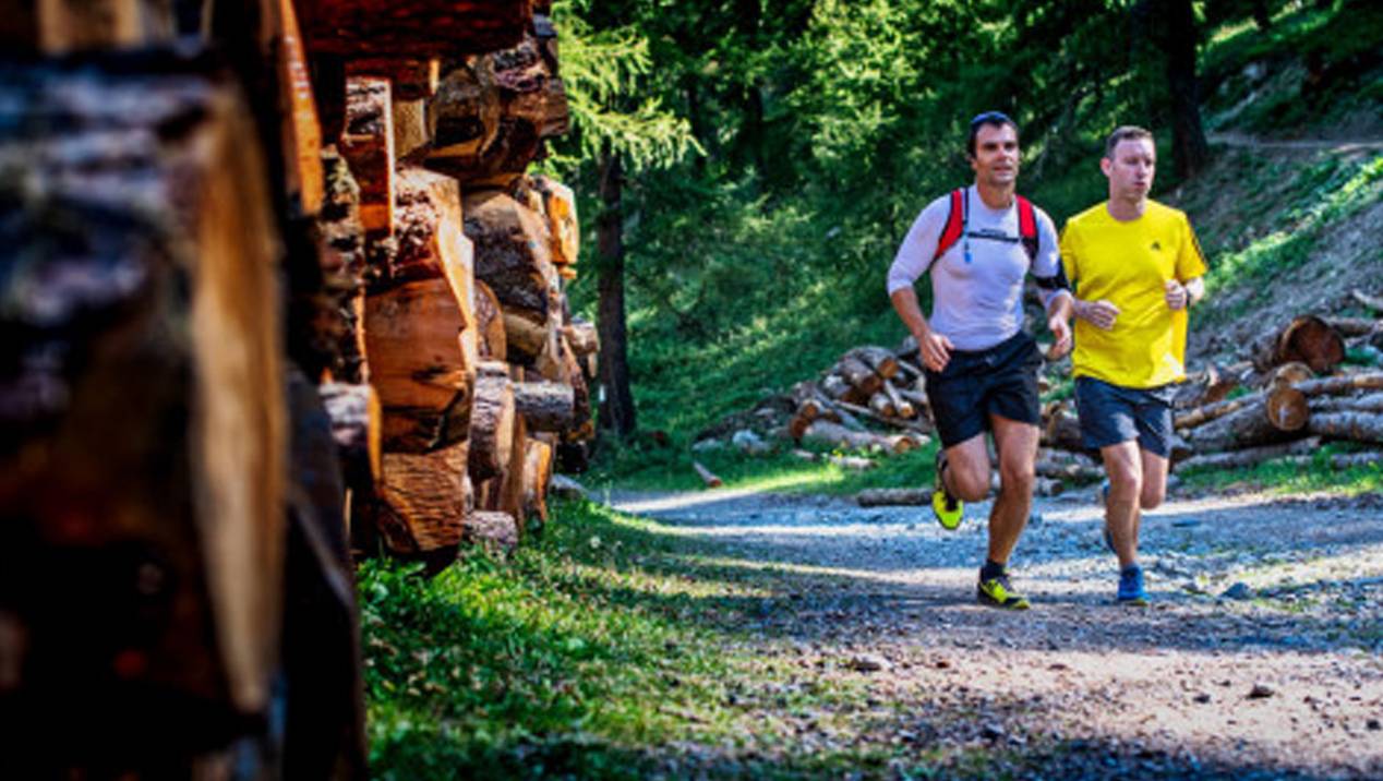
This loop is suitable both for beginner trail runners and more experienced athletes.
Your route: a gently undulating, single track through a larch forest An old, flat, irrigation channel provides an opportunity to limber up before then leading to a winding trail through the forest.
This trail has been used for years by local shepherds. The majority of the trail is shaded (80%), providing welcome relief if you want to enjoy some cooler air.
L'Epervière car park, Les Orres 1650. From Les Orres 1650 Tourist Office, head towards Les Pitchounets Children’s Club then follow the road upwards until you reach a small car park. The starting point is at the end of the car park.
Did you know?
This trail is named after Emile Hodoul, one of the resort’s co-founders and a forest ranger (Guard in French) who created it.
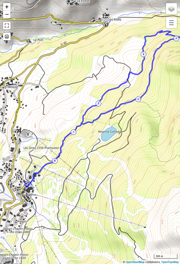
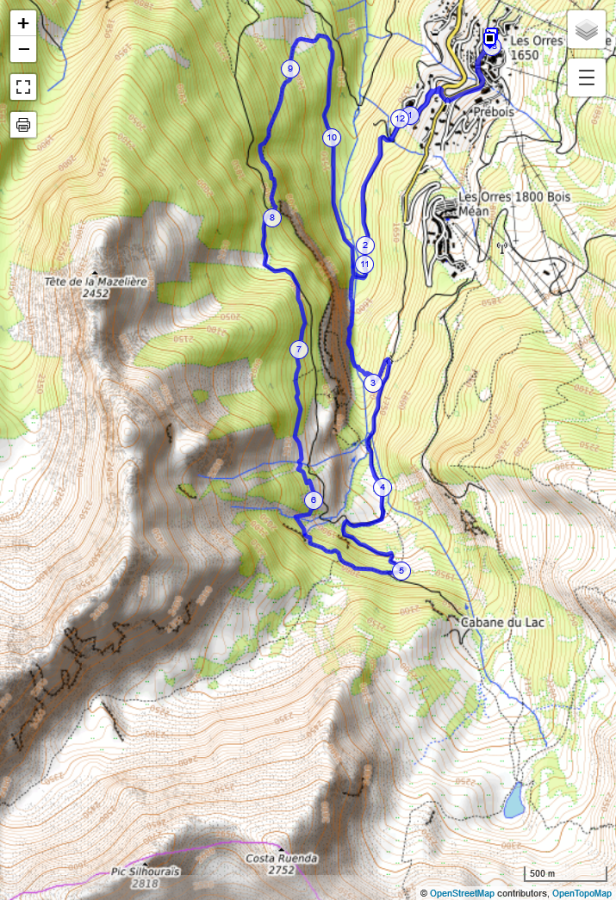
After a brief section through the undergrowth, continue up the 4x4 track for a few metres until turning left into an old flat, irrigation channel (1). At the end of this channel, you’ll start your ascent, passing the Cabane du nain rouge (Red Dwarf’s Cabin) (2).
Continue climbing through the woods. You’ll get to enjoy a beautiful, clear view of the village (3). Watch out for the narrow, vertiginous ridge: there’s a safety line to help you negotiate a few, tricky steps.
A little further along, the trail loses height as it winds through the forest (4). One final climb leads to a single, flat track which, in turn, leads to the irrigation channel at the start of the trail.
From here, you can return via the path you started out on..
Download (right click > save link as GPX file
This trail, which extends over a fair distance, is a chance to enjoy some fresh air: it runs alongside the the torrent de l'Eyssalette, traversing the Sources de Jérusalem springs and continues through undergrowth.
Along the way, you’ll get to enjoy a wonderful panoramic view of le Méale, l’Aupillon, le Boussolenc, the resort and the hamlets that make up Les Orres.
Opposite l’Estomac 1650 car park. From the Tourist Office, follow the main road towards Embrun until you reach the turn-off to Les Orres 1650 and Les Orres 1800. L’Estomac car par is on your right. From the car park entrance, cross the road to reach the single track that marks the beginning of the trail.
Head down towards the hamlet of Pralallègre and cross La Mazelière.bridge. Continue along a relatively level trail, where you’ll encounter the occasional cow, until you reach the pont de Roche Blanche bridge. Turn left to join a single trail which leads through undergrowth, climbing up towards the Bergerie Gautier cabin.
Follow the path until you reach the sources de Jérusalem springs(1): remember to turn right. At the barrier, turn right, downhill and cross over the springs to reach an old irrigation channel. Follow the path and enjoy the view of the resort.
Turn right at the cabane du Vallon (2). Follow the PR (Walks and Hikes) signs along this beautiful, downhill section, leading to the path that runs alongside the canal de Baratier and, eventually, the Pont de Roche Blanche bridge.
From here, you can return via the path you started out on.
Download (right click > save link as GPX file
This extremely demanding trail run takes you to the top of Le Méale, at a height of 2,426m, above the hamlet of Le Chef-Lieu, Les Orres.
Eighty percent of the trail, leading to the top of this pyramidal peak, is single track through the forest. You’ll love the 360° view of Serre-Ponçon valley, Les Orres resort, the Parpaillon massif and surrounding peaks.
Church car park in Chef-lieu, Les Orres. Take the main road to le Chef-lieu, Les-Orres. Go through the village until you reach the church, behind which you’ll find the car park.
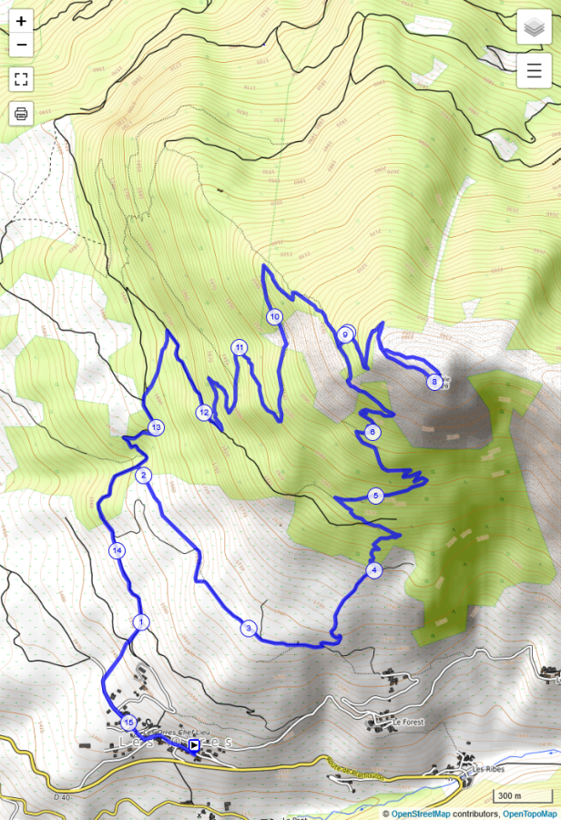
Take the rue du Commun which turns into a dirt track A single trail leads up to the Route du Méale (1); follow this trail until you reach the turning to the sentier de la découverte (discovery trail).
Continue along this track then turn left shortly before reaching the hamlet of Le Haut-Forest, followed by a challenging climb. Follow the winding path and continue climbing. You’ll reach La Platrière with its panoramic view of Serre-Ponçon (2). As you continue your ascent, the trail gradually opens up, revealing stunning views (3)
Turn right to reach the top via one of the two paths. And you’ve arrived! Make the most of the view before descending via the second short path and continue until the final junction where you turn right. After a series of bends, you will come to another track that you follow briefly.
Keep your eyes open: a single trail on the left will lead you to La Forêt car park; you need turn off this trail to reach the church, your starting point.
Download (right click > save link as GPX file

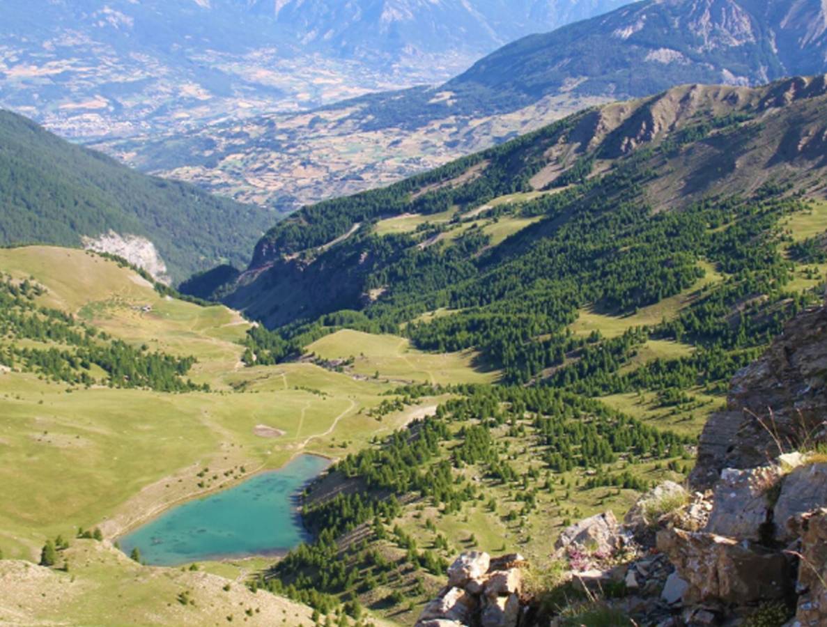
This long, highly technical trail, designed for seasoned trail runners will take you from mountain pastures to mountain ridge. You begin by exploring Lake Sainte-Marguerite (2227m) where you may be lucky enough to hear, and catch sight of, some marmots.
The route then leads to the Montagne de l'Alpe du Verdun, an impressive, high mountain with unspoiled flora. The trail culminates in a superb run along the ridge line just below the Pic de l'Aupillon (2916m), the highest point in Les Orres.
Bottom of slopes, Les Orres 1800 (Access from 1650 : via Les Marmottes ski slope or footpath).
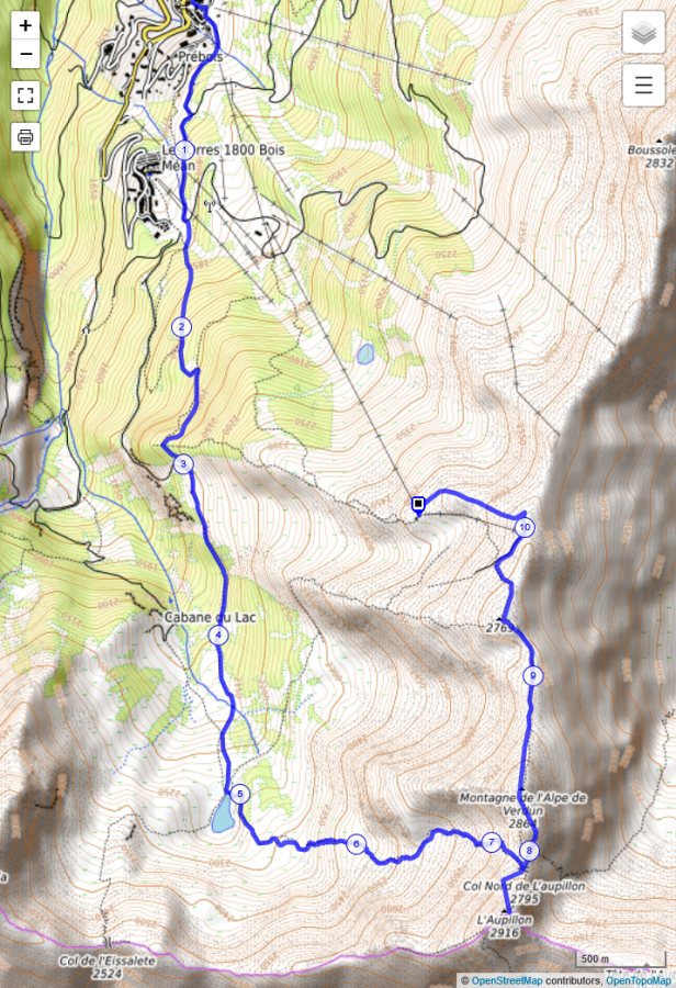
From the bottom of the slopes at Les Orres 1650, take the path on the left, shortly after the 2nd pylon of Prélongis chairlift. Continue along the path until you reach Les Orres 1800 and then follow a single, shady track leading to the Lac de Sainte-Marguerite trail.
Pass the ruined Cabane de l’Eyssalette hut and continue along the same path. Eventually, you’ll reach the mountain pastures, traversed by small streams, and Lac de Sainte-Marguerite (1). Now things start getting serious! A series of bends snake over 2km of rocky terrain leading to the Col de l’Aupillon mountain pass.
Are you ready for more? If so, continue up to the Pic, which stands at 2,916m, and admire the view over the Alpes de Haute-Provence department (2). Double back and follow the single track along the ridge leading to the head of the Vallon de Rémolon valley (3).
Follow one of the hiking trails to the top of the Pousterle chairlift. Descent by chairlift or on foot (several possible routes: consult the hiking map).
Download (right click > save link as GPX file