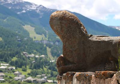
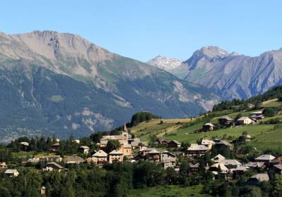
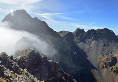
Image


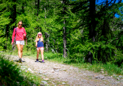
In Les Orres, hiking is one of the best ways to enjoy the great outdoors, discover magnificent landscapes, take naps in the grass, picnic in the forest or beside a stream. Whether you're a sports enthusiast with a penchant for steep trails or a fan of contemplative family walks, choose your itinerary, put on your mountain boots, hit the trails and breathe!
From spring to autumn, trails are accessible depending on snow conditions.
+ over 200 km of trails for all levels
32 marked itineraries
positive vertical drop from 15 to 1300 m
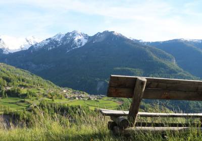
The Pic Vert, Prélongis and Pousterle lifts give you access to the upper trails with a pedestrian pass.
Thanks to the multi-activity pass, enjoy unlimited access to the pedestrian chairlifts and the Préclaux carpet all summer long.
DISCOVER THE MULTI-ACTIVITY PASS
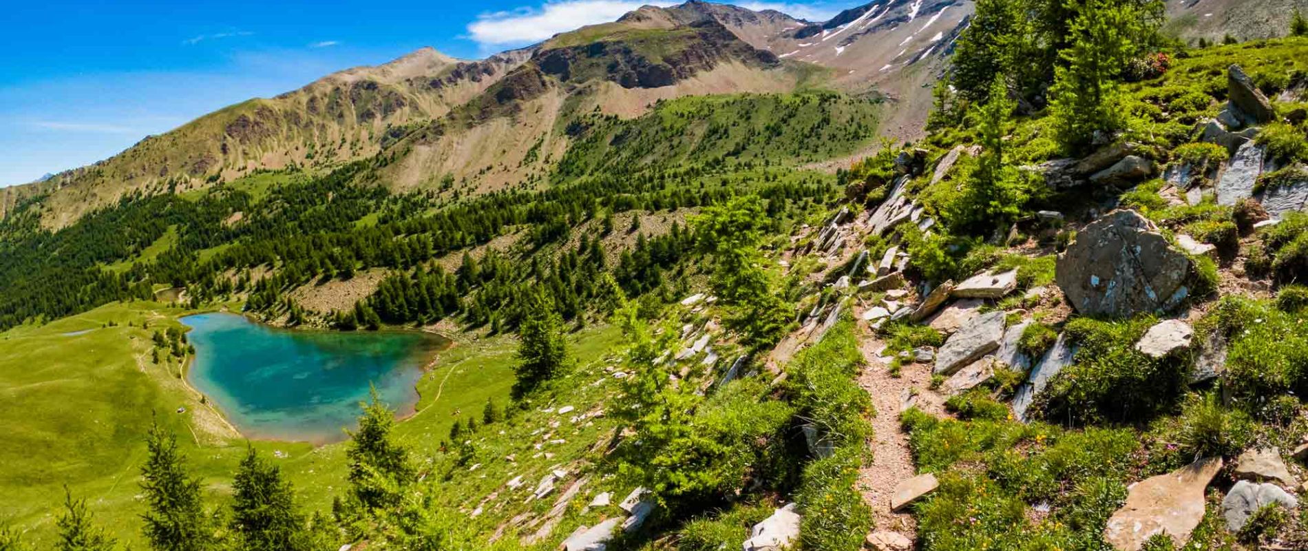
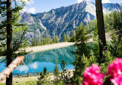
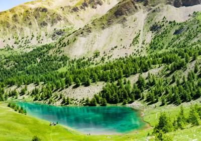
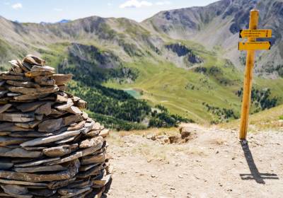
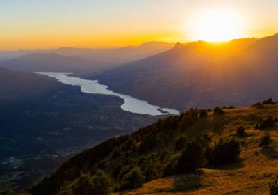
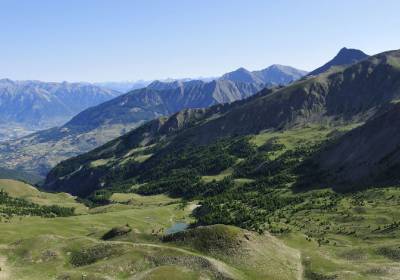
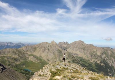
Want to get some height without too much effort? In summer, Les Orres' ski lifts provide easy access to the finest high-altitude hiking trails. In just a few minutes, you can reach the trailheads and set off to discover mountain landscapes: panoramic views of the Écrins and the Embrun valley, high-altitude lakes, forests and alpine meadows. Walking at your own pace, with children or on a more challenging hike, is one of the many pleasures of summer in Les Orres!

En quelques minutes, prenez les télésièges pour rejoindre les départs de sentiers et partez à la découverte des paysages de montagne : panoramas sur les Écrins et la vallée d'Embrun, lacs d’altitude, forêts et alpages.
Cerise sur le gâteau : rejoignez les restaurants d'altitude pour se rafraîchir avec un verre, partager un apéritif entre amis ou se retrouver autour d'un repas en terrasse. Farniente et détente avec vue panoramique garantis.
Marcher à son rythme, avec des enfants, ou en rando plus sportive, c'est l'un des nombreux plaisirs de l'été aux Orres !
Easy walks of between 1h and 1h30 to get some fresh air at altitude. The L'enfant des bois walk is ideal for children who are not used to walking. A great way to introduce youngsters to hiking! Prefer 360° panoramas? Take the Pousterle chairlift to Le Belvédère . The mountain is now accessible to the whole family , and ideal for those who enjoy a leisurely stroll!
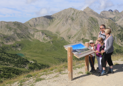
Head towards the viewpoint and its orientation table to take in the exceptional panorama of the Massif de l'Aupillon and the Massif des Écrins, as well as the valleys of...
My first hike ! A gentle trail in the shade of larch trees.
Arrival of the walk at Les Orres 1800
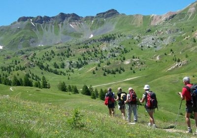
Do you hike from time to time, are the kids used to walking, or do you just want to get away from it all and enjoy the mountains of the Hautes-Alpes without coming home with painful aches and pains? These half-day outings, lasting between 2h and 3h30, are just what you need!
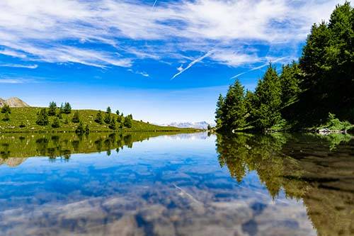
For a refreshing stroll, head for the emblematic Lac de Sainte-Marguerite or the aptly named Au frais des mélèzes. The Balcon des vallons offers breathtaking views.
From the top of the Télésiège du Pic Vert, enjoy a beautiful long downhill hike in the cool shade, winding through a larch forest.
You will pass the Réserve d’eau du...
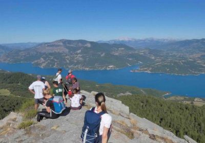
A magnificent panoramic view over the Grand Vallon, Les Orres, the Embrun valley, and the Écrins massif along this thematic ridge trail.
La randonnée incontournable des Orres ! Départ depuis le sommet du télésiège Pousterle, en passant par le Belvédère (n°4). Balade longue et aérienne.
Un havre de paix au...
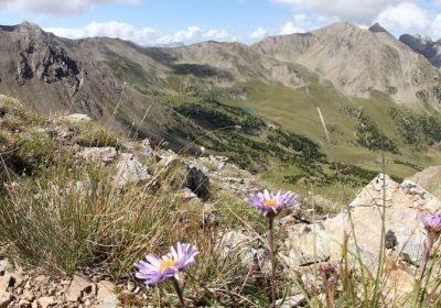
It's getting serious! Longer distances, steeper ascents and descents : while still accessible, these trails are suitable for regular hikers or those who are already a bit sporty. Magnificent panoramas await you on arrival.
To enjoy these breathtaking views, take the Cairns trail, the Col de Terre Rouge (caution: this area is closed at the beginning of July to protect the fragile Tétras Lyre) or the Aérien. This sporty trail will give your legs a real thrill!
A crossing trail with breathtaking views over Serre-Ponçon and the Massif des Écrins, through the red earth landscapes from the top of the Télésiège du Pic Vert.
Follow...
Follow the cairns, beacons for hikers, to the viewpoint indicator and its 360° view.
The Sports Trail is a hike reserved for experienced hikers. It is ideal for those who enjoy physical effort, with very steep slopes!

A breathtaking ridge-line hike before descending into the forest. Stunning panoramic views guaranteed, but the trail requires careful attention.
High points and aerial trails are the main themes of these hikes, reserved for seasoned walkers with mountain feet.
The Pic du Boussolenc (2282 m) can be reached from the Pic Vert chairlift, with a finish on the magnificent Col de Terre Rouge, or you can take the Pousterle chairlift up to the crests of Les Orres. Don't be afraid of heights!
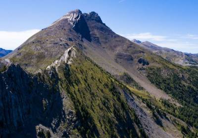
Set off to conquer the Pic du Boussolenc, which gets its name from being the last peak in the Orres area to be lit by the sun’s rays.

An unforgettable hike for those who are not afraid of heights. Long and technical, it is reserved for experienced hikers!
Throughout the route, you can enjoy panoramic...
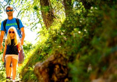
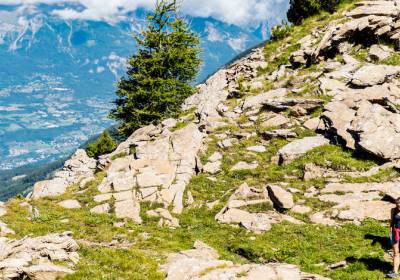
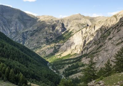
In Les Orres, numerous hiking trails are accessible directly from the resort, without having to use the ski lifts. From the resort, the village or the hamlets, set off on foot to discover the landscapes of the Hautes-Alpes: larch forests, torrents, mountain pastures and panoramic views of the surrounding peaks. Family outings, nature outings or more challenging hikes: everyone can enjoy the mountains at their own pace, in complete freedom, right from the start.
Make the most of the mountains! In Les Orres, several easy hikes are accessible without lifts. Perfect for a family outing, a leisurely stroll or a discovery of the Southern Alps landscape, these itineraries allow you to take time to observe nature, panoramas and little treasures along the way.
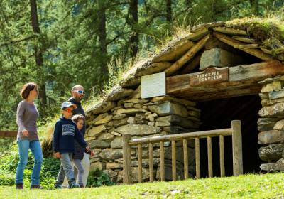
From the Pra Païsset parking lot, head for the Gautier hut (fully restored), and its picnic area in the mountain pastures.

Thematic course. 2 levels: 4/5 hrs (16km) or 1:30 (5.5km).

An easy out-and-back hike through the larch forests of Les Orres. A great spot for a picnic awaits at the destination!
Want to go a little further? Medium-level hikes offer a good balance between effort and discovery. Accessible to walkers accustomed to the mountains, these itineraries allow you to gain altitude, enjoy open panoramas of the Hautes-Alpes and discover a variety of landscapes, from forests to mountain pastures and views of the surrounding peaks.
A hike with a very beautiful viewpoint and a 360° panorama over the valleys of Les Orres, La Durance, and Crévoux, as well as a diverse flora. Le Méale peaks at 2426m

The Col des Orres offers a stunning view of the Barcelonnette valley. You might even be lucky enough to spot chamois and mouflons along your hike!

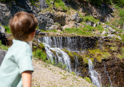
The springs of Jerusalem are an easy hike to do with the family, to cool off in the middle of summer.

Follow the water’s path and explore the beautiful larch forests of Les Orres, with stunning views over the valley below.

The must-do hike in Les Orres! Lake Sainte Marguerite is an ideal spot for a cool picnic. In the heart of beautiful alpine pastures still grazed by cows, you can hear and see...
Follow our Orrian shepherd "Lou Pastre" to discover, throughout the hike, how the inhabitants have used the elements to best adapt to the harsh mountain climate. A...
A hike in the heart of a wild and unspoiled landscape, surrounded by snow-capped peaks until early summer. This place is renowned for its abundant wildlife, including marmots...

A round trip in the shade of the forest. Beware of the trail with the same name, as its route is different.

A lovely loop in the peaceful larch forest, along ancient canals. A pleasant walk to enjoy with the family.
Looking for a real challenge in the mountains? Difficult level hikes are for experienced walkers. With a greater vertical drop and more challenging itineraries, they offer spectacular views of the peaks of the Hautes-Alpes and the opportunity to experience the mountains in all their intensity, between effort and wide open spaces.
From Sainte-Marguerite Lake, there is a challenging climb up to the Pass with views over the Haute-Provence Alp
Very difficult.(about 1:00 hr to go).
Magnificent panoramas await you on this technical hike! You have three options depending on your fitness level: reach the Col de Girabeau (2500m), continue to Petit Parpaillon...

Follow the Petit Vallon stream upstream to the Petit Vallon hut, then continue to its source. From there, take a steeper and more challenging trail. This final section requires...
Reserved for very experienced hikers, the very difficult level hikes in Les Orres offer demanding itineraries with steep gradients and technical passages. The effort is considerable, but the high mountain scenery is well worth it.

Panoramic views and a challenging hike to one of the iconic peaks of Les Orres. This route is reserved for experienced hikers who are not afraid of heights.
It is...
Starting from Lake Sainte-Marguerite (remember to add the time, distance, and elevation gain to the lake), follow the ridges of Les Orres to the summit of Aupillon, where you...

Starting from the lake (remember to add the time, distance, and elevation gain to the lake), hike through a beautiful valley to reach a panoramic view at Col de l’Âne, Côte...
Discover professionals and outdoor sports enthusiasts to accompany you in hiking, via ferrata, climbing, canyoning, high mountain activities, tree climbing, paragliding, and...
Discover mountain wildlife and flora, sunsets and sunrises, and unforgettable panoramas alongside experienced professionals: forest bathing hikes, meetings with shepherds, lily...

Escape into nature with Sarah on a snowshoe outing. Walking in the great outdoors provides a moment to relax, breathe in harmony with your steps, and awaken your senses.

A selection of 17 hikes of all levels, accessible without chairlifts, to take with you.
Departing from Le Chef-lieu, Les Ribes, Les Orres 1650 and 1800, these itineraries range from easy family outings to medium, difficult and very difficult hikes: explore the trails of Le Méale, Le Petit Vallon, Le Col des Orres, La Cabane du Nain Rouge and many other places to discover!
On sale at the Tourist Office
Price: €12
Prefer to hike from the chairlifts?

The mountain is grazed all summer long. When approaching a herd, pause, do not run. Don't pet or threaten the animals. Keep your dog on a leash.

Many of us enjoy the pure mountain air and the flora and fauna. To keep our landscapes as beautiful and protected as possible, let's follow a few simple, common-sense rules to preserve what surrounds us:
The best time to hike in Les Orres is generally from June to October, when the trails are clear of snow and the weather is most favorable. Summer allows you to take full advantage of the mountain scenery, larch forests, flowering alpine meadows and high-altitude lakes. It's the ideal season to discover the Hautes-Alpes on foot. Spring and autumn are also great for enjoying the peace and quiet and the flamboyant colors of the larch trees.
Yes, many hikes in Les Orres are perfectly suited to families. A number of easy itineraries allow you to walk gently, with little change in altitude, while discovering nature and mountain landscapes. It's an ideal activity for sharing a moment in the great outdoors with the kids.
Yes, the ski lifts provide easy access to the altitude and to many trailheads. It's the ideal way to enjoy mountain scenery and panoramic views without having to walk all the way up.
No, it's not compulsory. In Les Orres, some hikes are accessible directly from the resort or hamlets, without using the lifts. However, they also provide rapid access to higher altitudes and panoramic views, which can make certain outings easier or open up access to longer itineraries.
Yes, several signposted itineraries are available on site, and hiking maps allow you to choose your route according to your desired level and duration.
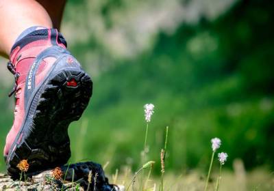
Good walking shoes, water, sun protection and a light jacket are recommended. At altitude, the weather can change rapidly, so it's important to be well equipped.
The hiking trails in Les Orres are varied:
Yes, the resort also offers difficult to very difficult hikes for experienced walkers. These itineraries involve a greater difference in altitude, longer distances and sometimes technical sections. In return, they offer spectacular scenery and complete immersion in the high mountains of the Southern Alps.
